
Cape Henlopen Chart map, Delaware Bay Chart 1918 Delaware Bay map Antique Map Style Map Nautical Map wall map print

$14.19 $19.44
Old Map of Delaware Bay 1918 Delaware Bay map Antique Map Restoration Hardware Style Map Cape Henlopen Chart map Nautical Map wall map art
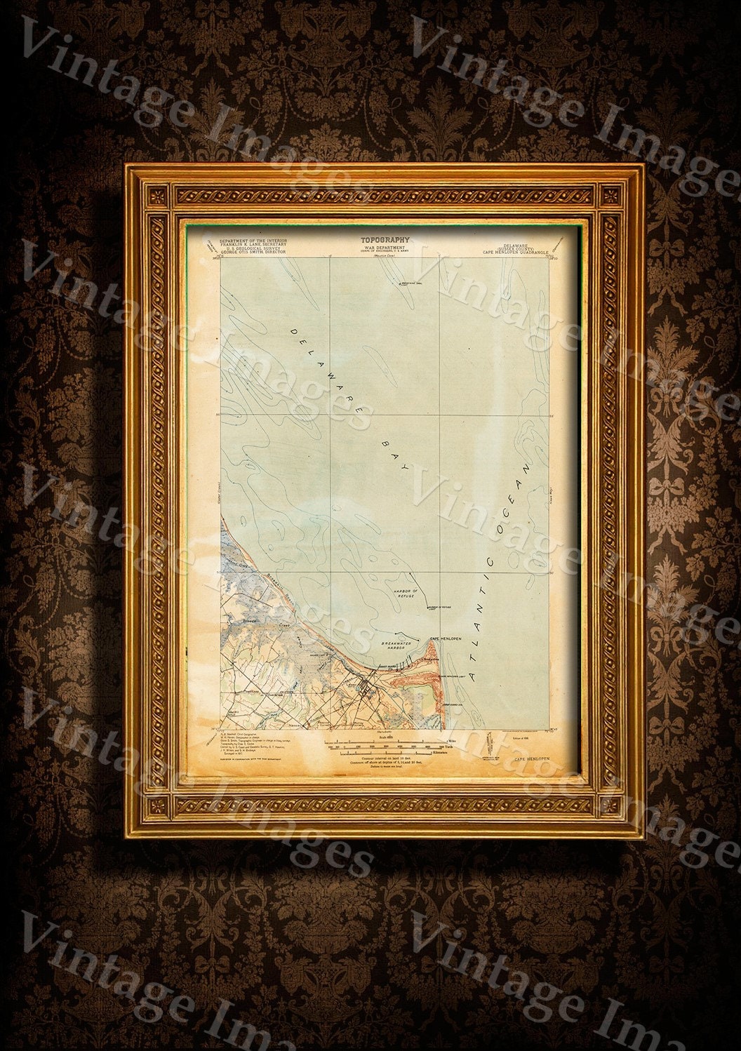
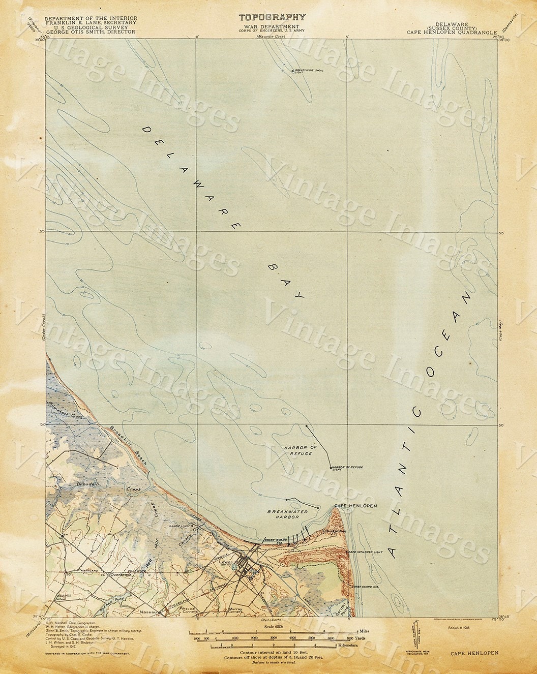
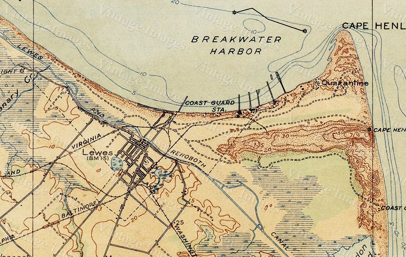
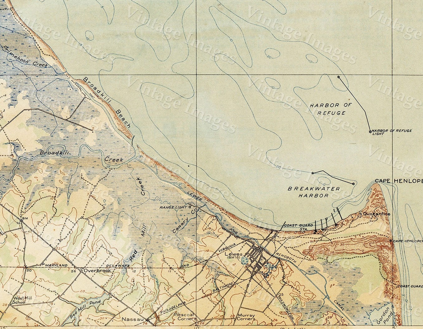
This beautiful map shows Delaware Bay from 1917
The bay is bordered inland by the States of New Jersey and Delaware, and the Delaware Capes, Cape Henlopen and Cape May, on the Atlantic. The Cape May-Lewes Ferry crosses the Delaware Bay from Cape May, New Jersey, to Lewes, Delaware. Management of ports along the bay is the responsibility of the Delaware River and Bay Authority.
Other names for the bay have been "South Bay" and "Zuyt Baye"
THIS WILL PRINTED ON SMOOTH FINE ART WATERCOLOR PAPER
This Fine Art Print has been reproduced from the original source .
using UltraChrome K3 Inks which are rated up to 125+ years
not cheap inks that will fade in 3 months
This map will include a border of white for framing and Matting purposes which can be trimmed off if needed (not included in the size)
very suitable for framing
Interior shots are for representation only your map may or may not be similar in size
PERFECT FOR YOUR HOME OR OFFICE
Thank you for looking.
Truly a rare find
Shipping from United States
Processing time
1-2 business days
Customs and import taxes
Buyers are responsible for any customs and import taxes that may apply. I'm not responsible for delays due to customs.
Payment Options
Returns & Exchanges
Returns & exchanges accepted within 30 days
Buyers are responsible for return shipping costs. If the item is not returned in its original condition, the buyer is responsible for any loss in value.
I gladly accept returns, exchanges, and cancellations
Request a cancellation within: 0 hours of purchase
The following items can't be returned or exchanged
Because of the nature of these items, unless they arrive damaged or defective, I can't accept returns for:
- Custom or personalized orders
- Perishable products (like food or flowers)
- Digital downloads
- Intimate items (for health/hygiene reasons)
- Items on sale
Questions about your order?
Please contact me if you have any problems with your order.
Reviews (8)
Average:
Feb 10, 2023
As described, would be nice if it wasn’t so curled up.
Tom Berger
Dec 11, 2020
Nina Colegrove
May 6, 2020
Shipped quickly, and product is as described.
Noelle
Feb 19, 2020
I bought a picture of the Delaware Bay that was awesome! I framed it and gave it to my boyfriend for his Birthday and he hung it up immediately. Print is beautiful, So happy with my Purchase!
Jess Boch
Jun 5, 2019
Excellent quality - had to look twice it looked so authentic! Thank you!
Maria Baer